
The Lycian Way in Short Stages: Reading the Coast from Fethiye to Patara
Choose thoughtful walks near Ovacık and Faralya, then read Patara as an ancient city without treating distant stops as one continuous day hike.
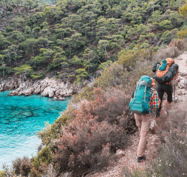
Choose a section, not a finish line
The Lycian Way is often introduced as an epic end-to-end challenge. For many visitors, its value lies in a carefully chosen section instead. Türkiye’s Ministry of Culture and Tourism describes a marked route from the Fethiye region towards Antalya with stages of varying difficulty. It connects viewpoints, settlements and archaeological landscapes, but those experiences do not all fit into one short walk. A better first question than “Can I finish the entire trail?” is “Which part can I understand and walk safely today?” This guide treats Ovacık, Faralya and Patara as distinct areas to explore. It does not turn the distance between them into a fictional continuous day hike.
A modern path through ancient geography
Lycia was an ancient region of the Teke Peninsula. The Lycian Way is a contemporary marked walking route through that region, not a promise that every metre follows an unchanged ancient road. The Ministry’s route portal divides the walk into mapped sections and sets historic places beside modern trails. On one day you may use a recent map, pass an older tomb and walk through a village whose life continues now. Calling all three things “ancient” would blur their meaning. Ask what is archaeological evidence, what is modern wayfinding and what is a living settlement. That distinction makes the walk more interesting than a simple claim of following ancient footsteps.
Start with the Ovacık area
The official route portal places the accepted start of the Lycian Way on the Ovacık side near Ölüdeniz. That does not exclude other worthwhile walks around Fethiye. Kayaköy, for example, belongs to a different local heritage story and appears in the CREAOS walking tour as a route towards Ölüdeniz. It should not automatically be described as every step of the official main trail. Choose a starting point according to your experience, the ground underfoot, temperature and a realistic return plan. A short section with time to read its landscape can be more rewarding than collecting a large distance. Make the beginning and end of your chosen walk explicit before setting out.
Look at Faralya from the right scale
Faralya sits above Butterfly Valley on the slopes beneath Babadağ. The Ministry’s trail information describes both its position and the route through this area. Seeing the valley from a viewpoint and descending safely to its floor are different activities. A shore that appears close in a photograph may require a steep, demanding approach on foot. Tell your guide whether the goal is a panoramic walk or a more technical route. Wind, rain, heat and trail conditions can change the decision. Check current local warnings and a safe way back before leaving. A memorable view never requires claiming that every visitor can or should reach the beach below it.
Read Patara as a city and a shore
Patara asks visitors to look beyond the sand. The official museum account identifies it as a capital of the Lycian League and describes its historical role as a harbour. Walk through the archaeological setting with that past in mind, then look at the present landscape and shoreline. A harbour can change over centuries; the land and water you see today need not match an ancient map exactly. The archaeological site and the beach can also have different access arrangements, so check current institutional information. Patara deserves its own pace. Do not assume it can be attached to an Ovacık or Faralya walk as a single continuous day on foot.
Define the stage before calling it easy
For any chosen section, ask where the walk begins and ends. Then discuss ascent, surface, shade, water, phone coverage and transport back. Official maps and route descriptions are useful planning tools, but even a current map cannot guarantee that every stretch is unchanged on the ground. Heat can make a modest distance demanding; shorter daylight can reduce the time available for a safe return. Set the pace for the slowest person in the group and leave room for photographs and historical interpretation. “Easy walk” is too vague to plan around. A concrete section, clear meeting point and honest description of the terrain are much more useful.
Use markers, maps and judgment together
Red-and-white trail marks help walkers follow the Lycian Way, as GoTürkiye notes. They are not a substitute for preparation at a junction. Save a current track and an offline map, charge your phone and tell a companion where you expect to finish. A closure, new road or erosion may alter the line on the ground. Follow official notices; if a section is unclear, turn back rather than inventing a shortcut. Guided walks still require suitable shoes, water and clothing for the conditions. The fact that the sea is visible does not tell you how demanding the next slope will be. A safe day starts before the first trail mark.
Leave the landscape readable
A walking route passes through both natural and cultural places. Cutting a new line across coastal vegetation invites others to widen it. Stay on established paths, carry out waste and never mark ancient stone. In villages, remember that homes and private spaces are not a visitor backdrop; ask before photographing people or their property. At protected archaeological sites such as Patara, follow staff instructions and boundaries. You do not need to step beyond a barrier for a meaningful view. Careful behaviour can slow a walk, but it helps keep the route and its heritage legible for the next visitor. Respect is part of the experience rather than a separate rule at the end.
Make a CREAOS plan that fits
The CREAOS Lycian walking tour introduces Kayaköy–Ölüdeniz, Faralya and Patara as points of interest. They should not be read as an automatic promise of one uninterrupted walk in a single day. Confirm which transfers use a vehicle, which parts are walked, the expected effort, guiding and any entry arrangements for your particular date. If archaeology is the priority, allow more attention for Patara. If landscape is the priority, choose an appropriate shorter section near Ovacık or Faralya. Mobility, children in the group and heat tolerance may change the plan. A private journey works best when it makes those choices explicit rather than promising every distant highlight at once.
What stays with you
The Lycian Way offers distinct memories: a trail above the water, an inhabited village or Patara’s harbour city. Short stages give each place room to make sense. Know where your walk begins and ends, and what you hope to notice. A handful of well-chosen steps can reveal a large, layered landscape.